
The History Of Chappel
This is your chance to get to know the history of Chappel. Most of the information here comes from British History online and there are links at the side of this page to take you direct to the horses mouth!
We would very much like to build a history of Chappel from its residents. Do you have a story to tell or know someone who does? Do you have any photographs or postcards showing Chappel from years past? We’d love to hear from you. Send an email to the website coordinator and we can take it from there!
Introduction
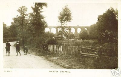
Chappel’s original name was Pontisbright and it is approximately seven miles west of Colchester. As with the name of the railway station, Chappel was part of both Wakes Colne and Mount Bures until 1889. Even today, it is shares boundaries and joint parish council meetings, as well as the post office, pub and viaduct with its neighbours, Wakes Colne.
However, it wasn’t always the case. In the middle ages, Chappel was part of Great Tey parish.
It was sometimes called a parish from 1483, but it was not separately taxed until the mid 16th century, and its status was still argued over in 1628. The ties with Wakes Colne and Great Tey were made stronger by the manorial structure and the western half of the parish was in Great Tey manor, with most of the eastern half in Crepping manor based on Crepping Hall in Wakes Colne.
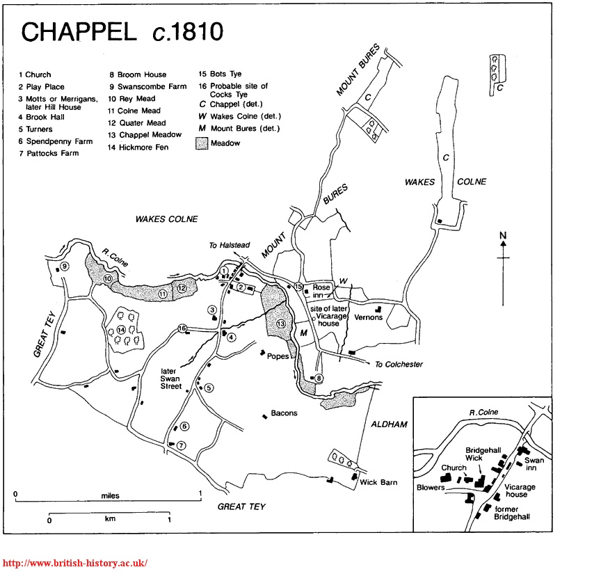
The parish, as surveyed in the 19th century comprised 1,176 acres including three detached areas in Wakes Colne and Mount Bures. Although under the Divided Parishes Act, some land was transferred from Chappel to Mount Bures and some from Chappel to Wakes Colne. Additionally, other land was transferred from Wakes Colne and Mount Bures to Chappel. The 20th Century parish contained 1,148 acres.
